So Long 2024
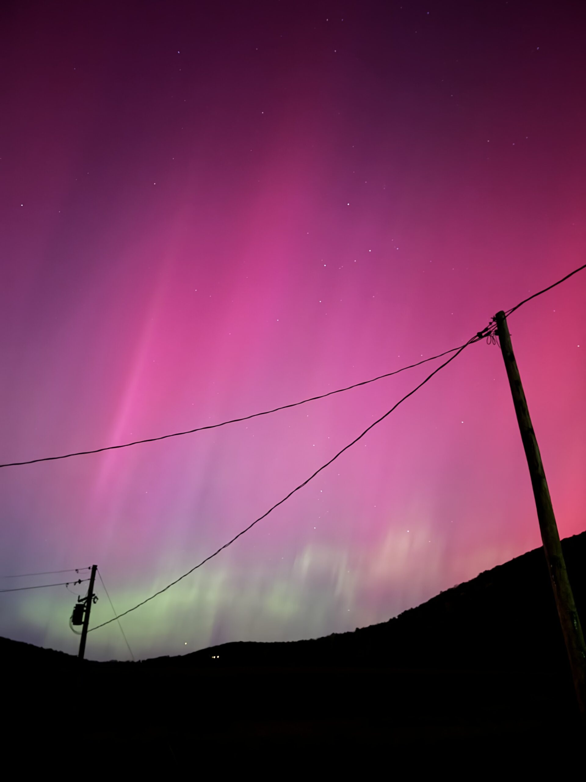
Nearly 1 – 2 feet of snow fell across the Twin Tiers last January, which quickly vanished as above average temperatures brought rain and wall to wall clouds from February to May. Cloudy days became the theme of spring, blocking out celestial events like the April 8th solar eclipse and the G-5 solar storm that sent the northern lights all the way down to Florida on the eve of May 11th.
July was disrupted by the buzzing of phones as New York turned into tornado alley, of which 23 were recorded in July alone. A far cry from the month’s average of only two tornadoes. This was the most ever in state history since records began in 1950, according to the Storm Prediction Center’s preliminary report . Record setting temperatures that helped fuel these storms continued through the summer and into fall making 2024 the hottest year on record per the recent climate report from NOAA, who’s records date back to 1850.

2024 was full of other memorable events including a 4.8 magnitude earthquake in New Jersey that rattled the ground from NYC to the Twin Tiers on April 5th. Thankfully, this was just a harmless shock that even went unnoticed by some. Sadly the same can’t be said by the 2024 hurricane season, which totaled over $500 billion dollars in economic loss according to an estimate from AccuWeather.
Many recall Hurricane Debby, which was a tropical storm by the time it tracked into the Twin Tiers and sent rivers & creeks out of their banks in parts of western New York and north-central Pennsylvania. Just a month later Hurricane Helene turned cities like Asheville into rivers as 15-30 inches of rain fell across western North Carolina leaving thousands without power & fresh water for weeks. Over 200 lives were lost in this biblical (1 in 1,000 year) rain event.
While many other events rewrote the 2024 history books including the first ever Category 4 Hurricane during the month of June, last year wasn’t all gloom and doom. Folks in the Northeast finally got their once-in-a decade viewing of the aurora as clear skies set in on the night of October 10th. And with the current solar cycle just reaching it’s peak, there’s a good chance 2025 will provide another glimpse at the lights.

Winter’s in the Air
Over the last two winters above average temperatures have led to a severe reduction in snow cover across the eastern United States and much of Canada, leaving grounds unfrozen and trees susceptible to disease. 2022 was actually the last time the Great Lakes reached over 50% ice coverage (since 2019) with the past two years holding at or below 20%. So far the 2024-25 winter has delivered on the cold, which could push the Great Lakes back up to that 50% benchmark (or higher) and support ice jams along area rivers should sub-freezing temperatures persist into February.

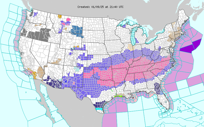
A recent cold spell visited the Deep South triggering winter weather from Dallas to Charlotte on January 9 & 10th. Cities like Hot Springs, Arkansas received a foot of snow while Birmingham and Atlanta saw freezing rain and 2-4″ of snow & sleet, which is nearly 150% of their annual snowfall!
The last time a winter event of this significance hit the Atlanta Metro was a decade ago in January 2014. Locals know this storm as “Snowmagedden”, which trapped a million drivers including over 90 school buses as everyone tried to rush home all at once. Now the Georgia DOT is much better equipped to handle snow with capabilities of making 50,000 gallons of liquid brine per hour to treat their roads, and have nearly 400 snow removal dump trucks, according to a Fox 5 Atlanta article.

With the El Niño-Southern Oscillation (ENSO) laying in more of a neutral to weak state of La Niña this season, other global weather patterns like the Polar Vortex have been among the primary influencers of winter. This generally compact circulation that exists at the top of the poles has become stretched or elongated allowing arctic air to dive southward towards the equator. In conjunction with a persistent ridge (or high pressure) across the eastern Pacific, a direct tap to the cold has been opened on the central and eastern parts of the country.
In the Northeast, some areas are already on track to see above average snowfall, which includes places like the Greater Binghamton Airport. So far just over 50 inches of snow has been recorded, which surpasses last year’s seasonal total according to the National Weather Service in Binghamton. Even places like Baltimore-Washington are performing well this year with two recent snows in January totaling over half a foot.
Temperatures on the other hand have come in below average for the month of December and early January making for what finally feels like a true winter. Many even got to celebrate Christmas with a bit of snow on the ground, which is usually not the case 60% of the time. Now with plenty of cold in the air, might there be signs of warmer weather to come?
Taking the Plunge
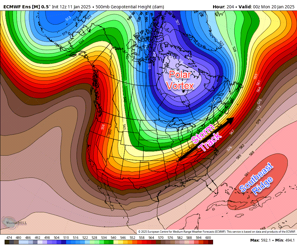
According to several reliable weather models, the Polar Vortex will lock into place over Eastern Canada during the coming weeks, which may make for some interesting weather as a ridge of high pressure builds in against it from the south. This will set up a pretty extreme gradient of temperatures known as a baroclinic zone, which can often create for a dynamic weather pattern. With a lack of upper-level blocking to the east, these upcoming winter storms may be rather progressive (or quick moving) vs. long and drawn out, but that doesn’t mean they won’t be big!

As for the cold, there’s plenty of that to come. January will continue to feel like winter with arctic air scheduled to return this week setting us up for lake effect snows and a favorable storm signal during the 18th-20th. From there the Polar Vortex (pictured above) will reinforce this polar plunge during the fourth week of January with temperatures falling well below zero, perhaps even ten below in spots. More trouble may even be brewing for the South later in the month as this sinking jet stream takes the chance of blockbuster snow back into the southern states.
What remains of question is the strength of the so-called “southeast ridge”. Should that area of high pressure over the Caribbean become more influential to the pattern, it could certainly try to push some milder air back north as we turn the calendar into February. Long-range models indicate a potential trend back to near or above-normal temperatures next month, which could also mean bigger storms and wintery mixes. Until then, the current pattern is locked and loaded waiting to unleash on the East.
