December Rains
With big rains and swift moving creeks here at the year’s close, it’s hard to look at December 2023 and think of winter in the same sentence. Snow has been short lived and hard to come by, which is fairly common for the month considering average snowfall is only around 7.0″ for the valley areas and closer to 14″ for in the snowy spots of the Twin Tiers. Given the nearly +4 to 7°F departure from our monthly average, it’s easy to see how we are already a half foot behind.
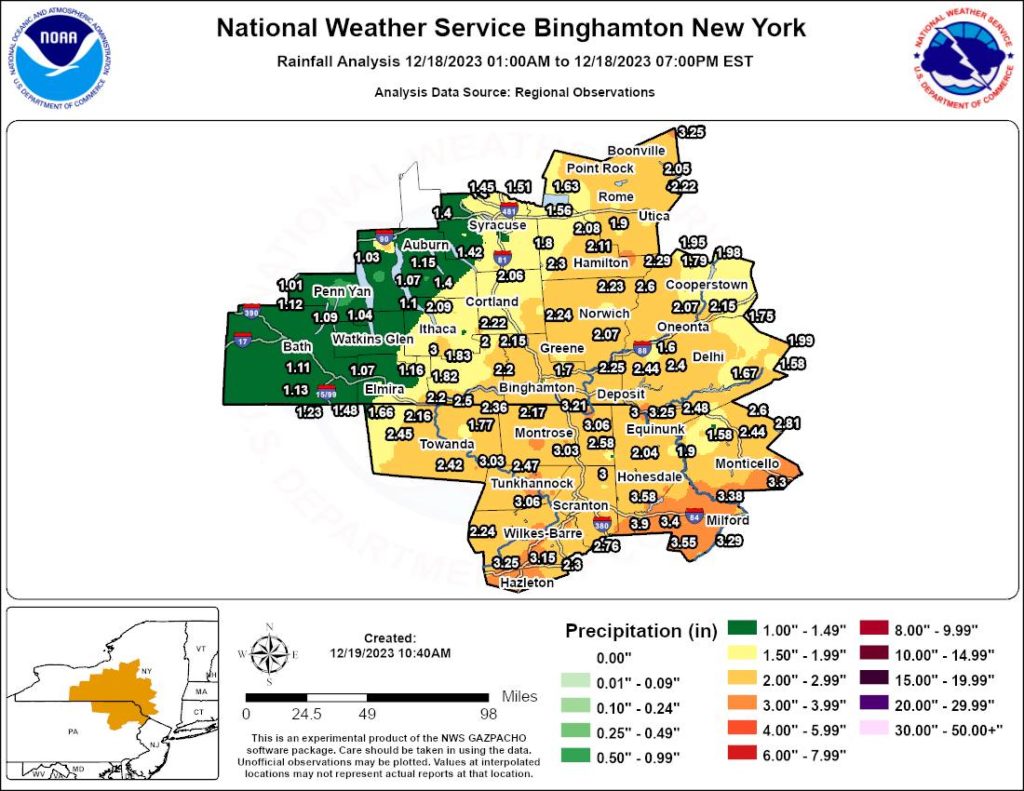
There certainly has been no shortage of rainfall this month following what could have been the snow storm of the season, except it fell as 1 to 3 inches of rain (as seen in the graphic below). Equating that to snow, we probably missed out on about 20 – 30 inches, which would have closely rivaled our 30-40 inch nor’easter three years ago on December 17th.
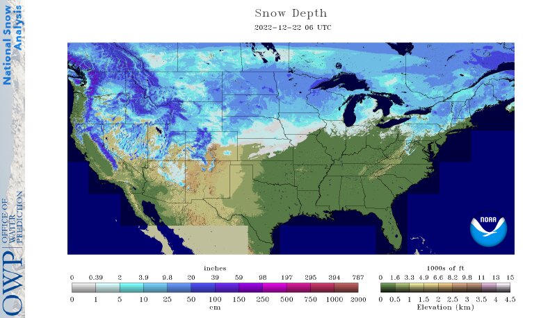
Looking across the country, it’s hard to ignore the impacts of El Niño with much of the U.S. and southern Canada stuck in a snow drought (as seen below). Out in Anchorage, Alaska; however, they recently set a record for the snowiest 45-day period ever with over 73 inches of snow, and more to come. Much of this is attributed to the Aleutian Low that continues to batter that part of North America, and the injection of warm air from the Pacific, which governs our snowless season here.
So Where Do We Go From Here?
While we are starting to see the return of cooler nights, daytime highs will continue to soar above average as we near the holiday season with temperatures reaching 50°F in spots on Christmas Day. So those dreams of waking up to a blanket of white likely aren’t coming true this year, which we only really have about a 40-50% shot of that happening anyways here in the Twin Tiers.
So more rain? Well, not on Christmas Day thankfully, but the following days (on December 26-27th) will bring yet another storm that could have, but instead results in about one inch of rainfall… Too bad we don’t have the ability to change this over to snow. The window from December 28th-30th may be our last hope at snow this year as the lake effect machines become active, only to be turned back off as the ball drops in New York City and high pressure builds into the East.
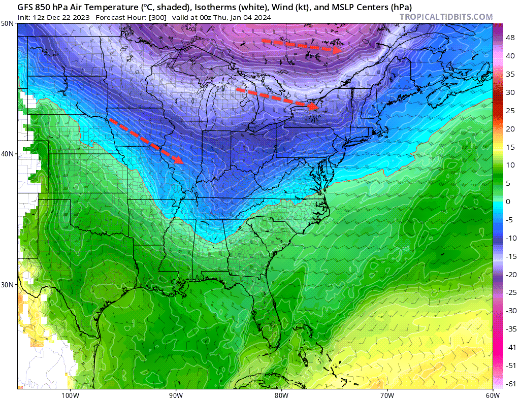
With the approach of the New Year comes new hope and a good sign that winter may make a brief return during the first week of January as near to below average temperatures funnel into the Northeast. Unfortunately for snow lovers, this air from the arctic is bone dry, which means we may still have to rely on the Great Lakes to bring us some love as the pattern doesn’t appear to be primed for big snow just yet. But the chances are growing with the official welcoming of winter supported by short days, a low sun angle, and a cooling Northern Hemisphere.
Winter with El Niño
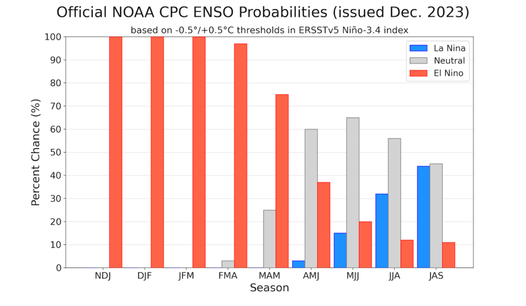
Conditions remain very warm in the Central Pacific Ocean as El Niño holds at what may now be it’s peak temperature of 2.0°C; just a tenth of a degree shy of a what would be considered Super El Niño status. From here, El Niño is anticipated to hang on through the winter months before trending downward as we near March and April, perhaps reaching the neutral phase (between -1°C to +1°C) come May.
Still, it’s not easy to say how this trend will impact our winter as it may be months before we really notice any affect. But judging by the current state of affairs and the lack of snowpack across North America, it’s easy to assume that this winter might underperform despite the surplus of rain we’ve received.
El Niño has held up it’s end of the bargain so far with an active storm track in the East and above average temperatures. If we are to see any big changes, we might expected them in the first 6-10 days of January and perhaps again towards the month’s end. So regardless of this slow start to the season, we maintain our forecast of near average snowfall for the Twin Tiers and continue to lean low for Scranton to the Poconos with hopes of a somewhat back-loaded winter. In other words, it may be wise to keep those shovels close because the show has only just begun.