November Recap
Before we jump forward in time, let’s take a quick look back at November for those that might be curious to see how we compared to the norm… Some of our warmest temperatures occurred within the first two weeks of the month with peak highs in the low-mid 70’s on November 5th and 6th. Syracuse International Airport actually hit 80F! Let’s hope you took advantage of these days.
Things cooled down pretty quickly from there heading into the mid section of the month with several nights in the 20’s F and even upper-teens. Then despite the cold signals I mentioned in last month’s blog for Thanksgiving, most of us ended up enjoying their turkey with temperatures in the mid-50s F! This warm-up helped to round out the month about 1-2 degrees above our normal monthly average.
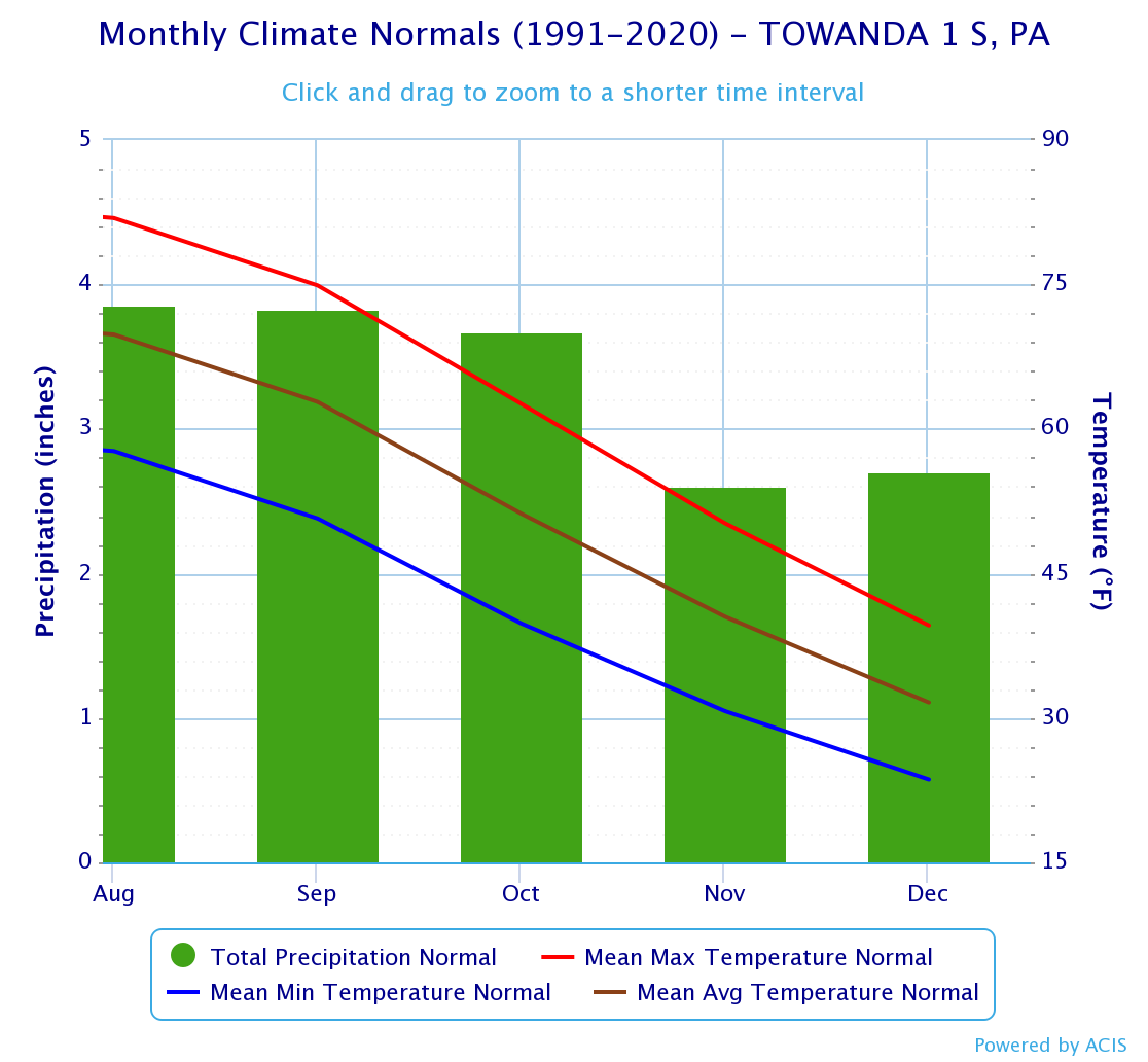
As far as precipitation, we had one big rain event on November 11th from the remnants of Tropical Depression Nicole, which dropped anywhere from 2.0 – 3.0″ of rain across the Twin Tiers. This essentially pushed us over our monthly total rainfall average in one event (compare it to the graphic above). Then the lake effect machine turned on. (You can check out photos of the 6-7 feet of snow that shut down some of the Buffalo Southtowns by clicking here.) For the Twin Tiers, between a few lake-effect squalls and the 3″ snowfall event in the middle of the month, we ended up close to our monthly snowfall average and finished with a positive rainfall departure of about 1.0 – 1.5″.
Where Will December Go From Here?
Up to this point, December has been trying to figure out whether it wants to be warm or cold, which really isn’t out of character for the last month of the year especially with La Niña controlling the global climate scale. Through the first seven days, temperatures have averaged nearly one degree above normal for many areas, which was right on par with the long-range forecast. Now we are starting to see other influencers bleed into the pattern, perhaps offering more opportunities for colder weather, mixed precipitation, and even snow.
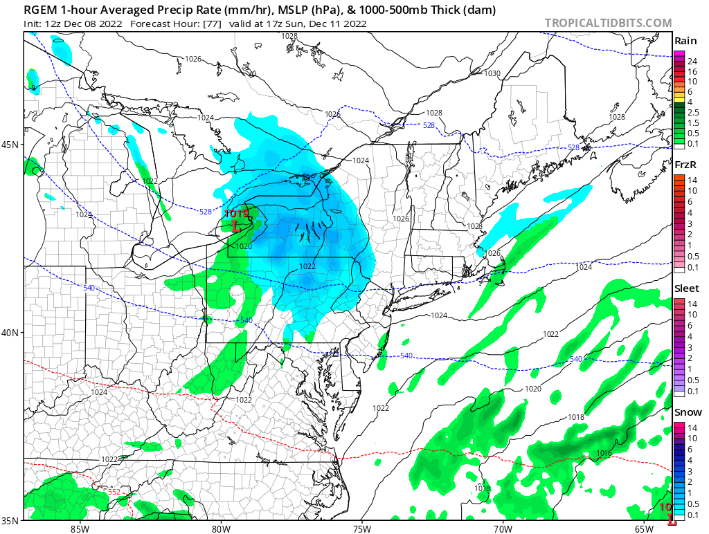
Weather models have been offering up some wild solutions for a potential winter event this Sunday with snowfall amounts as much as half of a foot! Thankfully for Sunday travelers there are at least a couple factors in place that may limit the upper-end potential of this system. Following a cold start, marginal daytime temperatures should offer some opportunity for snow covered roads to melt back during the afternoon, especially with the assistance of salt applications. This system is also a fairly quick mover, keeping our window for moderate snow relatively short lived before the storm’s supporting energy and moisture is refocused offshore into a developing coastal low. I’d say 1-3″ is a good starting forecast.
Below average temperatures settle in following this weekend, which will play a vital roll in the precipitation type for the next event during the Wednesday to Thursday timeframe. If cold air from the nearby high pressure system is still in place, it may very well undercut a huge surge of moisture tracking in from the southwest, perhaps delivering a wintry mix of freezing rain and snow. With that said, we’ve seen this all too many times where cold air is overdone by weather models in the long range. So I do suspect the leading warm front with this system will play a hand in changing some areas to plain rain.
Closing Out 2022
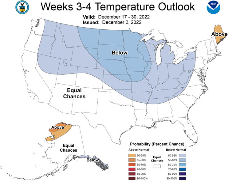
As signaled last month in my blog, the pattern looks to break down further during the second half of the month leading to some wild swings of weather. We’ve been stuck with this anomalous blocking high pressure over Greenland, which should gradually weaken over the next couple weeks while remaining in a favorable spot for storm development on eastern seaboard. With expected interactions from the Polar Vortex and a favorable Eastern Pacific Oscillation (EPO), colder bouts of artic air will surge into the heart of the country, offering a good shot for the Northeast to round out the month with near or below average temperatures and a couple more rounds of winter weather.
Our Chances for A White Christmas
Being a traditionalist, I’ve always enjoyed the idea of a snow on Christmas. Unfortunately most of the Christmases I can remember were socked in with cloudy skies and wet, muddy grounds.
According to the National Oceanic and Atmospheric Administration or NOAA for short, there’s usually a pretty good potential for a white Christmas if you live in the Twin Tiers. Odds actually aren’t far from a coin flip’s chance, roughly 40-60%, to have an inch or more of snow on the ground for Christmas Day. (See the graphic below for your area.)
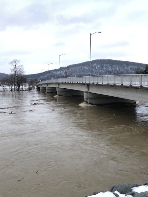
Here’s some fun holiday facts based on records from the Binghamton Regional Airport. Our snowiest Christmas Day since 1951 occurred in 2002 with a whopping 12.7 inches. As for our wettest Christmas, 2020 holds the title at 0.80 inches of rain. But let’s add that to the inch or so that fell on Christmas Eve that year for a two-day rainfall total of about 2.0″. You might recall this rain event that melted almost all 40 inches of snow that was on the ground nearly sending the Susquehanna River over it’s banks.
So which way do the odds lean for this Christmas? Well if we were to take a look at the last two years (since they were also La Niña winters), our chances for snow on Christmas look bleak. Thankfully there is still a good signal that the pattern should remain active (and cold) with a weak blocking high pressure system forecast to linger to our the east. All in all, I’d say the odds are leaning in favor of a white Christmas.
You are far more accurate than any of the “big box” weather folks. (You’re making Snedeker look retarded on WNEP.) I think you should take his job from him!